Routes & nearby · Pai, Mae Hong Son
Pai Canyon and Pai Memorial Bridge
The historic bridge is another Route 1095-area stop. Visit the bridge in good daylight to read its interpretation, then choose a safe viewpoint at the canyon; confirm the bridge’s current access on site.
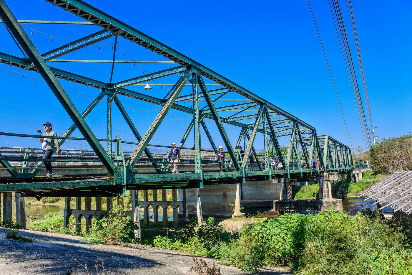
About Tha Pai Memorial Bridge and visitor access
Tha Pai Memorial Bridge is a separate attraction in Pai District, not part of the Pai Canyon ridge trail. Local access, maintenance, vendors and any entrance rules are managed according to the relevant site arrangements. Follow posted notices and staff guidance at this location; the forest recreation project described for Kong Lan must not be assumed to operate this separate place.
Tourism Authority of Thailand visitor information ↗History and character
The bridge is associated with wartime transport routes in Pai. Interpretive accounts distinguish the original wartime crossing from subsequent structures and repairs; read the signs at the bridge rather than assuming every visible beam dates to World War II.
What to observe
Compare the bridge spans, riverbank setting and historic information boards. Photograph the whole crossing from a safe approach rather than standing in traffic or crossing a restricted section.
Tha Pai Memorial Bridge · Google Maps ↗Essential visitor information
Location
Tha Pai Memorial Bridge, Pai, Mae Hong Son, Thailand
Type of attraction
Historic river bridge and interpretation stop
Entry
The general viewpoint is commonly visited without a ticket; verify any onsite service charges.
Suggested duration
About 30–90 minutes; allow for travel
⚠ Check any local closures and route conditions on the day of travel.
Explore the place
The site recalls wartime transport between northern Thailand and the Burma frontier. The visible crossing has a layered history of reconstruction and adaptation, making explanatory signs and the relationship to the river as important as the structure itself.
Visitor recommendations
The historic bridge is another Route 1095-area stop. Visit the bridge in good daylight to read its interpretation, then choose a safe viewpoint at the canyon; confirm the bridge’s current access on site.
Opening hours
Outdoor access can vary with repairs, weather and local restrictions; confirm the usable crossing on site.
Tickets and prices
The general viewpoint is commonly visited without a ticket; verify any onsite service charges.
Getting there
Follow Route 1095 south of Pai toward the historical bridge. Use the bridge’s own Google Maps search result, not the canyon pin.
What makes it special
Compare the bridge spans, riverbank setting and historic information boards. Photograph the whole crossing from a safe approach rather than standing in traffic or crossing a restricted section.
History, landscape and local culture
The bridge is associated with wartime transport routes in Pai. Interpretive accounts distinguish the original wartime crossing from subsequent structures and repairs; read the signs at the bridge rather than assuming every visible beam dates to World War II.
Step-by-step walking route
- 01
Arrive in daylight and read the bridge history panels.
- 02
View the whole span and river from a safe approach.
- 03
Continue along Route 1095 to Pai Canyon if weather and daylight allow.
Suggested visit sequence
- 01
Check the weather and road conditions before leaving Pai town.
- 02
Park responsibly, walk to the broad first viewpoint and assess the ground.
- 03
Take photographs from stable ground and return before darkness.
Before you visit
Check any local closures and route conditions on the day of travel.
Photography positions
Photograph the full span diagonally from a safe riverbank viewpoint; details of rails and decking work as secondary images. Keep clear of moving vehicles and restricted sections.
Where to stay
Pai town is a practical base for combining the bridge with Pai Canyon, food stops and the evening market.
Visitor reviews
Ratings shown here belong to Pai Canyon itself, not to other nearby attractions.
Open this place on Google Maps ↗Pai Canyon landscape photographs
Visitor questions
Is Pai Canyon suitable for everyone?
The first overlook is a shorter visit, but even the approach can be uneven. Narrow exposed ridges are optional and unsuitable for some visitors.
Can I visit after rain?
Wet red-earth paths are slippery and exposed edges can erode. Stay off narrow ridges after rain or storms.
Where is the correct map location?
Use the Pai Canyon Google Maps place link below. Nearby attractions require their own separate map search.
Location and navigation
Tha Pai Memorial Bridge, Pai, Mae Hong Son, Thailand
Open this place on Google Maps ↗